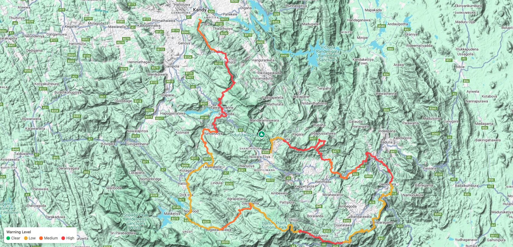
Sri Lanka’s central highlands continue to stabilise following the recent extreme weather. Our on-ground field teams have now fully mapped the hikeable sections of The Pekoe Trail. This verified assessment enables hikers to plan responsibly, understand terrain conditions, and walk with informed awareness.
Most of the trail remains hikeable with caution. However, hikers are advised not to travel alone. Instead, move with a group or a Trail Host (guide) and follow weather advisories closely. If a stage is not listed below, it is currently CLOSED.
It is very important during this time that all hikers obtain a trail pass. This is for hiker safety.
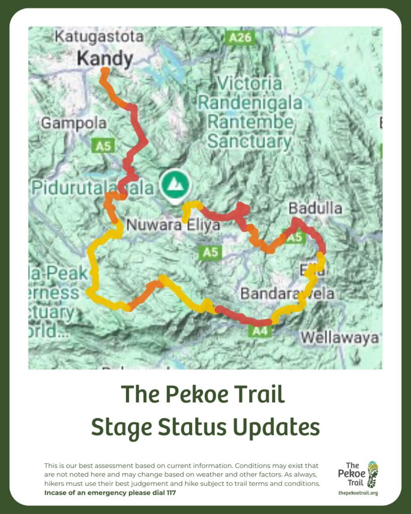
🟡 MINOR IMPACTED STAGES
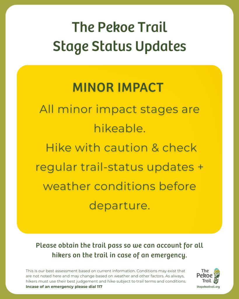
The following stages have been verified as being hikeable. Expect vegetation, detours or weather-related slow sections.
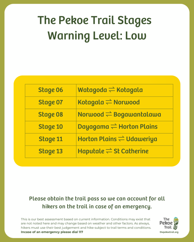
Stage 6 — Watagoda → Kotagala
- 100m detour
- 2.4km overgrowth
- signage impacted
Stage 7 — Kotagala → Norwood
- 30m detour
- 1.7km overgrowth
- signage impacted
Stage 8 — Norwood → Bogawantalawa
- 1.1km overgrowth
Stage 10 — Dayagama → Horton Plains
- Minor landslides near access road
Stage 11 — Horton Plains → Udaweriya
- Minor end access blockage
Stage 13 — Haputale → St. Catherine’s
- 200m overgrowth
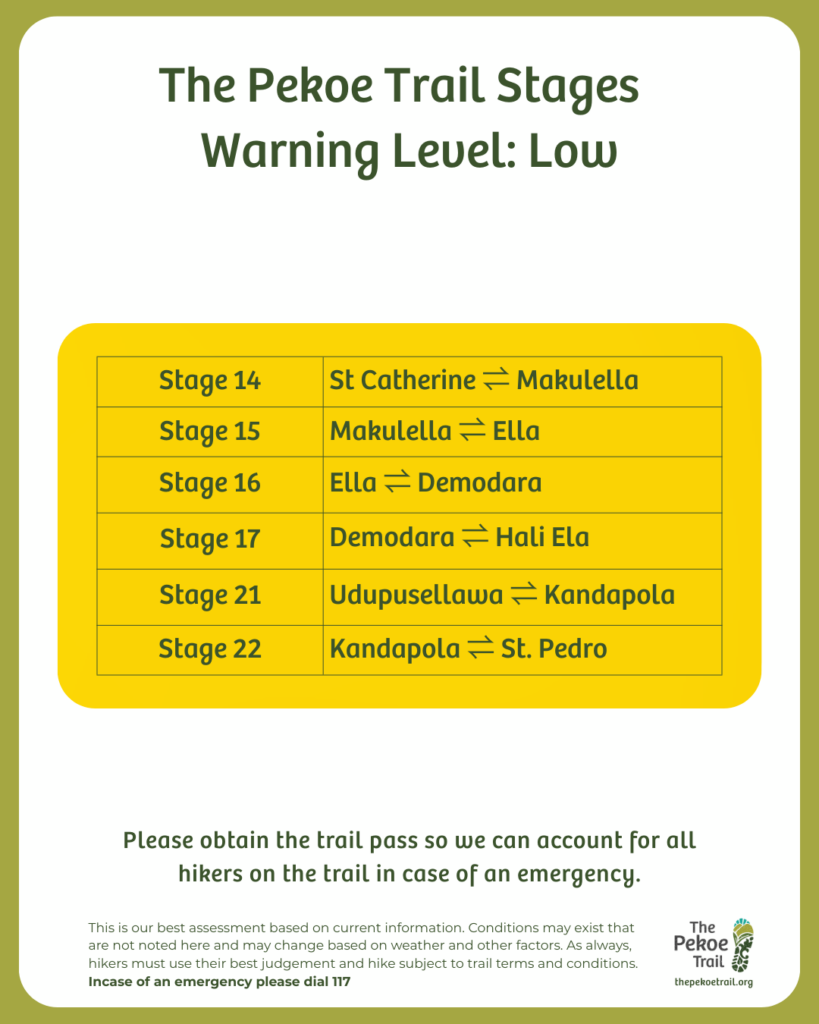
Stage 14 — St. Catherine’s → Makulella
- Weather dependent caution
Stage 15 — Makulella → Ella Trail
- Fully accessible + motorable
Stage 16 — Ella → Demodara
- Small slide
- Overgrowth
- Road bypass available
Stage 17 — Demodara → Hali Ela
- Minor impacts
Stage 21 — Udapusellawa → Kandapola
- Minor impacts
Stage 22 — Kandapola → Nuwara Eliya
- One small water crossing
🟠 MODERATE IMPACTED STAGES
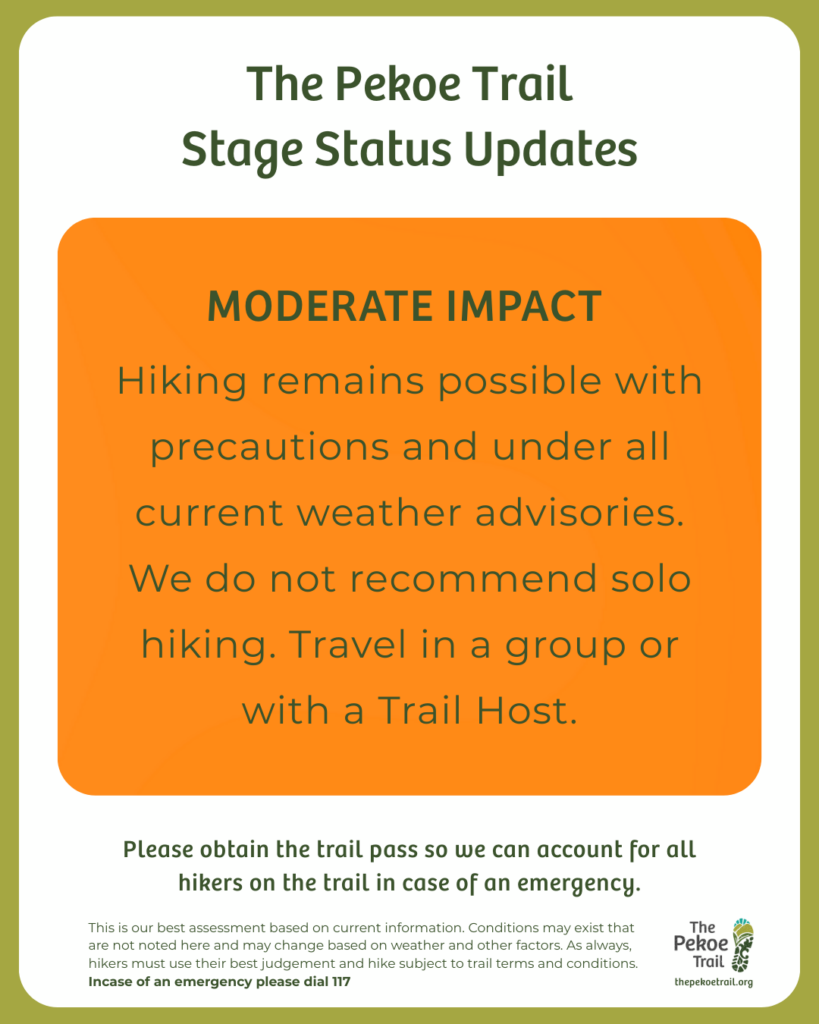
Hiking possible on the following stages, but there have been moderate impacts. Proceed with awareness and group safety.
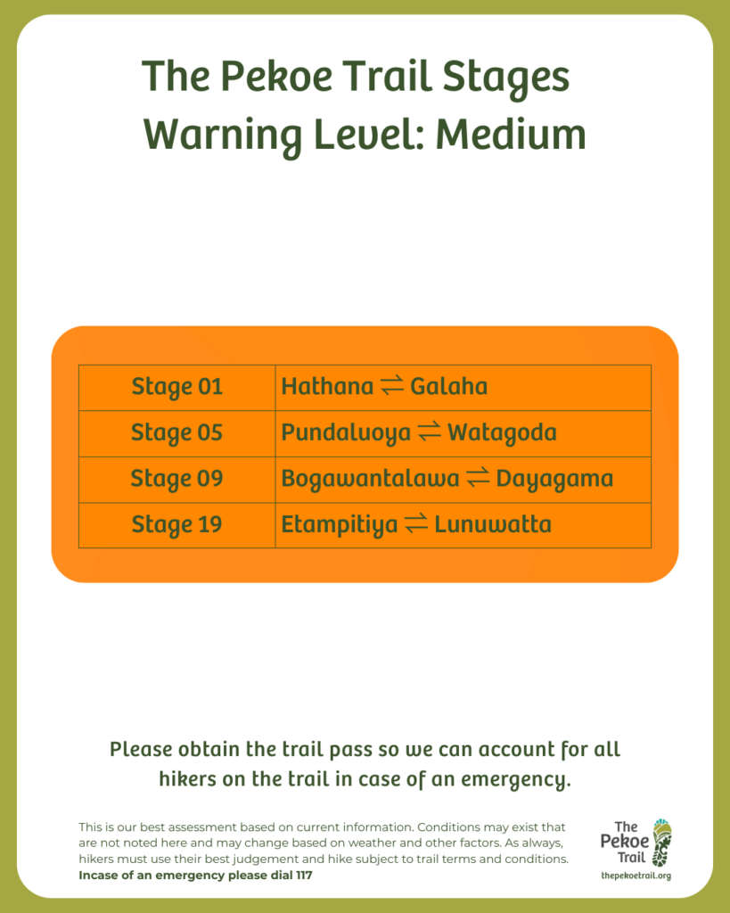
Stage 1 — Hanthana → Galaha
- 2 landslides (1 minor / 1 moderate)
- Fallen trees
- Minor signage impact
- Mud and erosion visible along sections
Stage 5 — Pundaluoya → Watagoda
- Trail open, but access via Thawalantenna is cut off.
- Recommended approach via Watagoda / police-guided access.
Stage 9 — Bogawantalawa → Diagama
- Approx. 200m mud hazard at Haritha Kandha, some signage disturbed.
- Extra caution required near Jacob’s Ladder.
Stage 19 — Ettampitiya → Loonuwatta
- Trail remains open, but exit roads are not motorable.
🔴HIGH IMPACTED STAGES
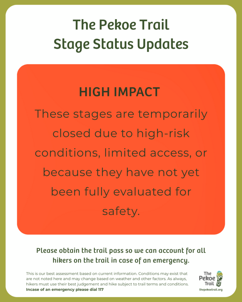
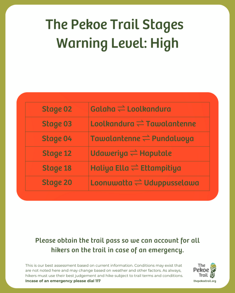
These stages are temporarily closed due to high-risk conditions, limited access, or because they have not undergone full safety assessments. Please wait for further updates.
Stage 02 — Galaha ➝ Loolkandura
- Severely impacted by landslides
Stage 03 — Loolkandura ➝ Tawalantenne
- Access difficulty
- Warning level elevated for safety
Stage 04 — Tawalantenne ➝ Pundaluoya
- Access road cut off
- Major Landslide and debris reported
Stage 12 — Udaweriya ➝ Haputale
- Flagged for landslide risk
- Closed until further assessment
Stage 18 — Haliya Ella ➝ Ettampitiya
- Closed until field assessments are completed
Stage 20 — Loonuwatta ➝ Uduppusselawa
- Closed until field assessments are completed
This is our best assessment based on current information. Trail conditions may differ on the ground and can change rapidly due to weather. Hike responsibly and always use your best judgement.